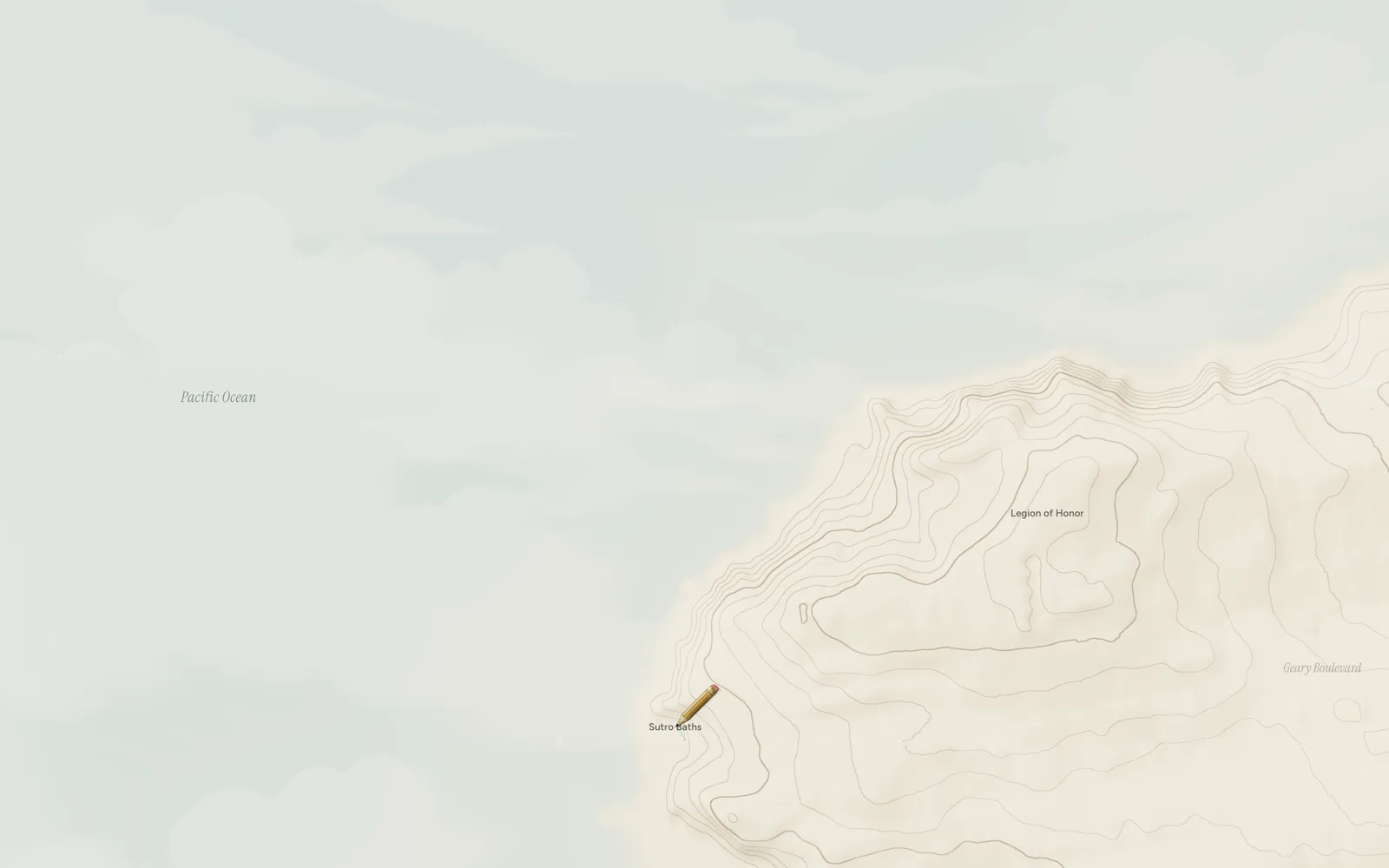
Lands End in San Francisco under a parchment fog with contour lines, the Pacific and the Golden Gate in a calm blue-grey. A drafting pencil rests at Sutro Baths, where the walk begins.

Plate 1 Lands End, San Francisco, 37.78° N

Every walk clears the fog.

Waymark lays a parchment fog over the real map of the world. Walk, ride or drive, bring in years of old routes, and the fog lifts wherever you've actually been. It all stays on your iPhone.

Waymark A private atlas of everywhere you've been

Download on the App Store

Free. Waymark Plus is a one-time purchase.

For iPhoneNo accountStays on your phone

Level2

New ground 290,485 m² 3.2 km

Newcomer. Every atlas starts as a blank page.

Scroll to walk

Plate 2 How it works

Walk. The fog clears.

  1. Carry your iPhone.

    Waymark records in the background with the screen off, and can start by itself when you set off. GPS runs only while you're moving and sleeps when you're still, so a normal day costs a few percent of battery.

  2. The fog lifts where you went.

    About 50 metres either side of your route and 80 around a photo, or 10 or 95 if you'd rather. Every area and percentage counts what the fog shows up close.

  3. Watch your places fill in.

    Every new street counts. The card under the map gives your share of the place you're looking at, like 12.162% of San Francisco; the City tab adds the ground around home, your county in the US, and any place you track or search for. Climb from Newcomer to Atlas, with 33 medals along the way.

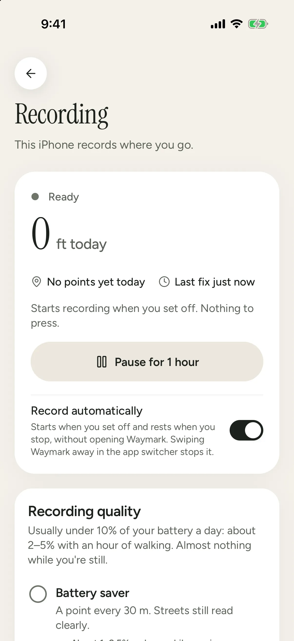
Settings › Recording in Waymark, This iPhone ready: 0 ft today, the last fix just now, Starts recording when you set off, nothing to press, a Pause for 1 hour button, and Record automatically on.
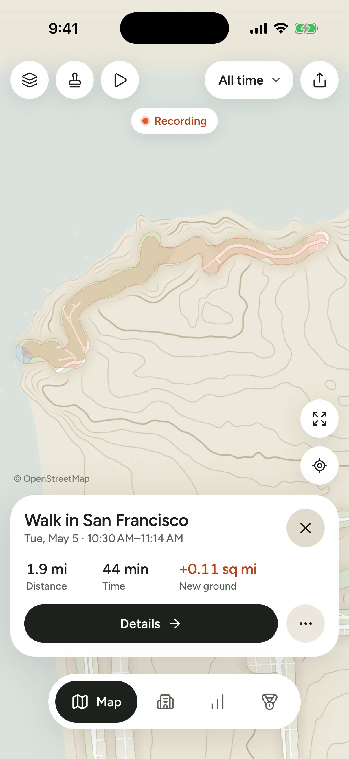
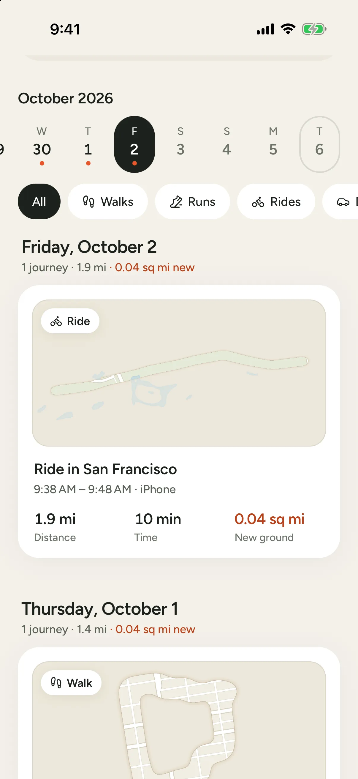
The Map in the Atlas style: the Lands End walk selected, the strip of coast it cleared tinted in the parchment fog, and its card: 1.9 mi, 44 min, 0.11 sq mi of new ground.
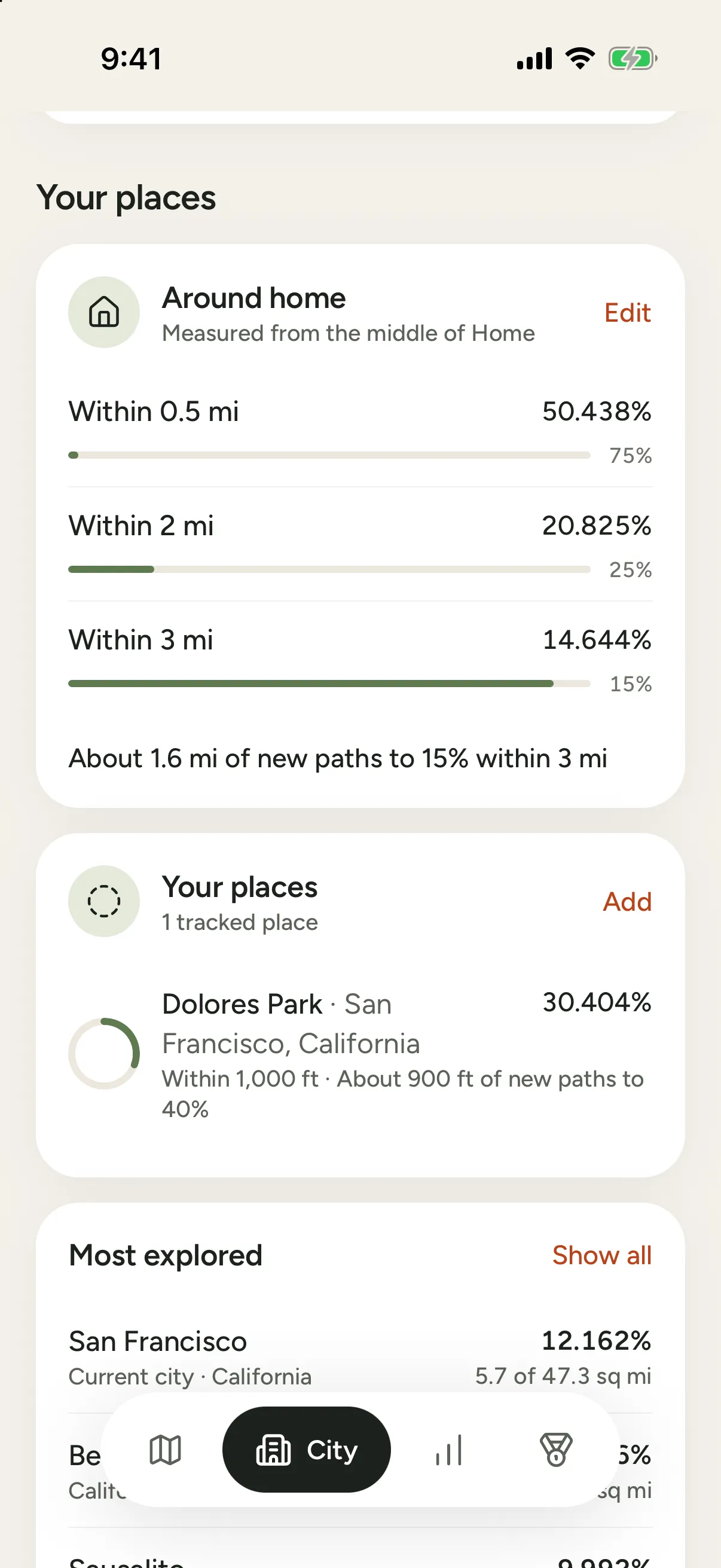
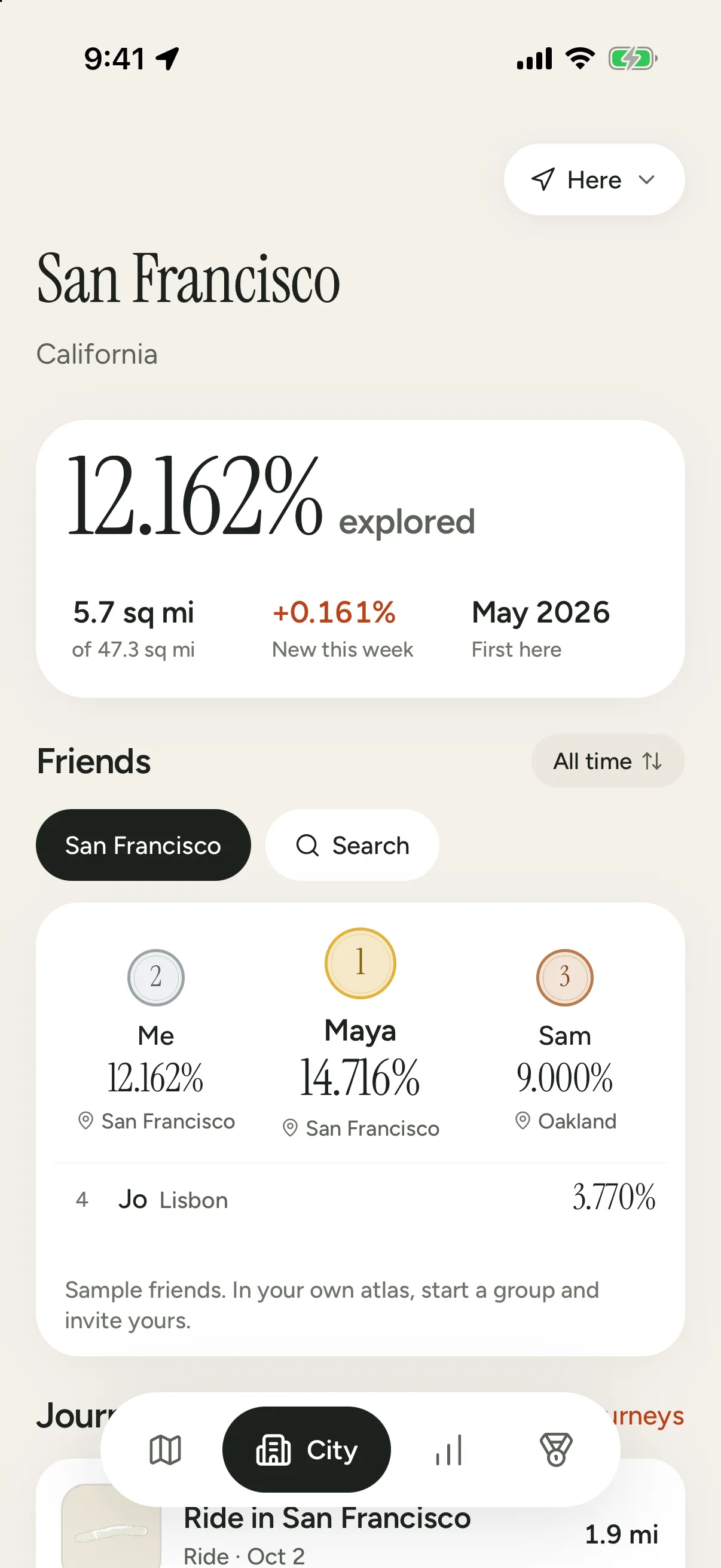
Your places on Waymark's City tab: around home 50.438% within 0.5 mi, 20.825% within 2 mi and 14.644% within 3 mi; Dolores Park, a tracked place, at 30.404%; and San Francisco, the current city, at 12.162%.
  • Battery saver, Balanced or Precise. Pick how often it logs a point.
  • Records with the screen off. Your phone stays in your pocket.
  • Places only. Cities and countries, for almost no battery.

Plate 3 Sample atlas: five cities, 123 journeys

Start with the years you already have.

Your photos, your Google Maps Timeline and your old GPX files already know where you've been. Waymark reads them on your phone and fills in the map in one go.

Every import shows a preview first, and can be undone.

San Francisco
Big Sur
New York
Lisbon
Tokyo
  1. Photos

    Where and when each geotagged photo was taken. The photos stay on your iPhone.

  2. Google Maps Timeline

    The export from your phone, or an older Takeout file.

  3. GPX, KML and GeoJSON

    From Strava, Garmin, Komoot, AllTrails and most route apps.

  4. Fog of World

    Your Sync folder, rebuilt as routes.

  5. Apple Health

    Workout routes, read straight from Health.

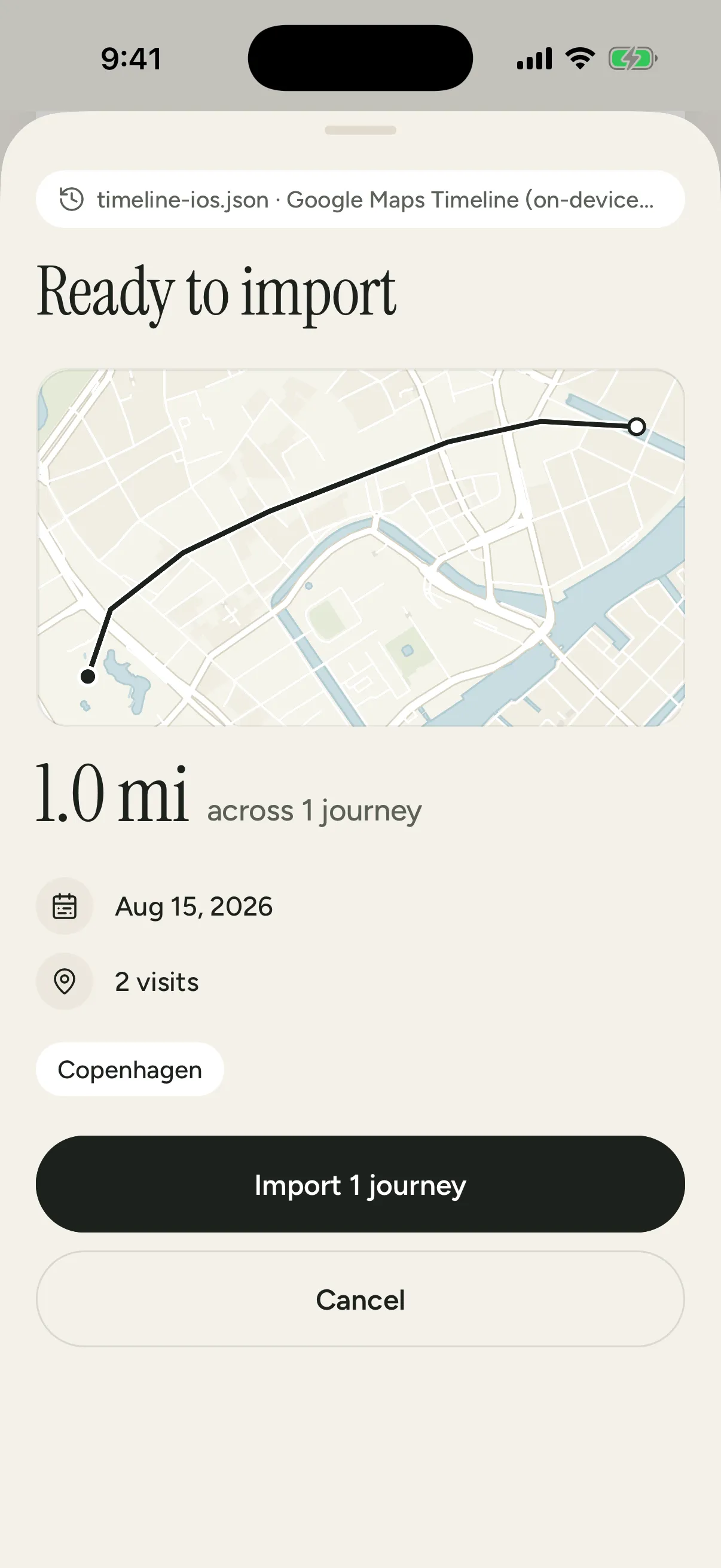
An import preview in Waymark for a Google Maps Timeline file: a route sketch over Copenhagen, 1.0 mi across 1 journey, and an Import button.
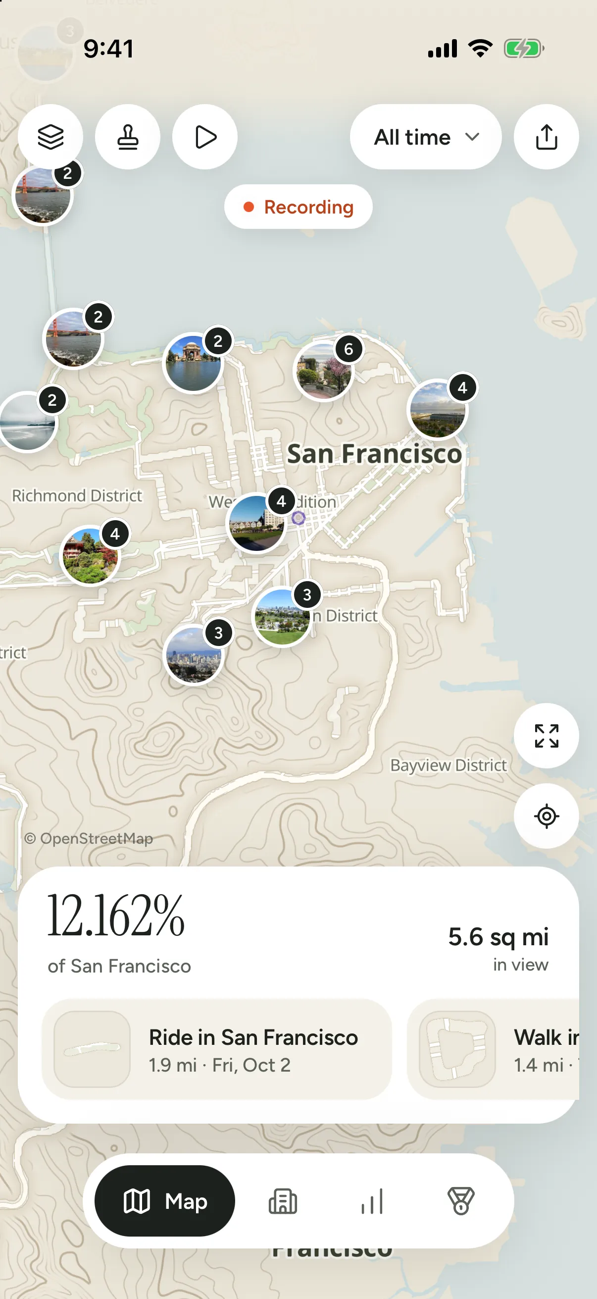
Waymark's map of San Francisco, the ground its journeys cleared opened through the fog and photo pins clustered along it: 12.162% of San Francisco explored, 5.6 sq mi in view.

Plate 3½ City

Race your friends to clear the city.

The City tab shows the place you're in and how much of it you've explored. Invite friends through iCloud and race them for it, all time or this week; they see your share, never your map. Every walk, ride and drive stays in the journal, as the ground it cleared.

An engraved old city by a river, most streets faint, one walked route inked through them.
The walked streets inked, the rest left faint.

Free. Plus is a one-time purchase.

Get Waymark on the App Store
  • San Francisco · 37.7749° N 122.4194° W
  • Eagle's Point · 58 m
  • Reykjavík · 64.1466° N 21.9426° W
  • Mexico City · 19.4326° N 99.1332° W
  • Lisbon · 38.7223° N 9.1393° W
  • Marrakech · 31.6295° N 7.9811° W
  • Buenos Aires · 34.6037° S 58.3816° W
  • Cape Town · 33.9249° S 18.4241° E
  • Singapore · 1.3521° N 103.8198° E
  • Tokyo · 35.6762° N 139.6503° E
  • Sydney · 33.8688° S 151.2093° E
  • Free on the App Store

Plate 4 Scratch map

Scratch the world off.

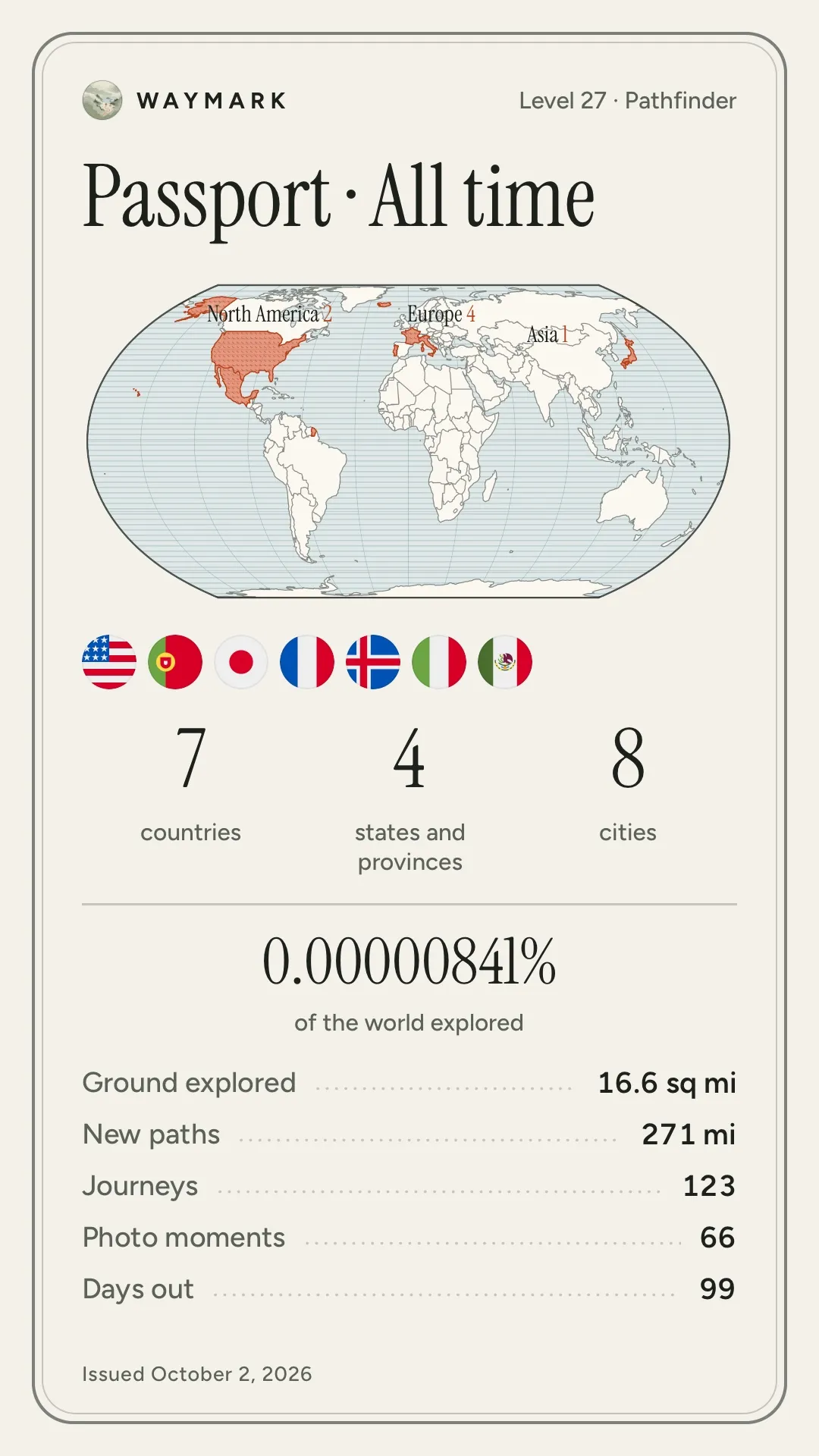
Countries, states and cities fill in from where you've actually been. The places from before Waymark, you scratch off by hand. Your passport puts it all on one page to share: all time, a year or a recent month.

10 countries

Tap a country to scratch it off.

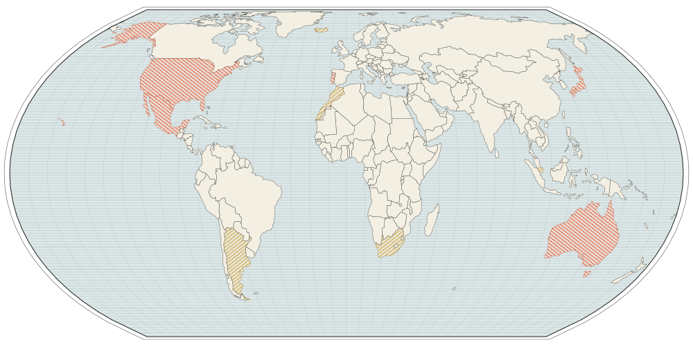
Pl. IV The world, scratched off The United States, by state Cities, as you explore them

Equal Earth · Natural Earth 1:110m Albers · Alaska and Hawaii inset, not to scale An example atlas
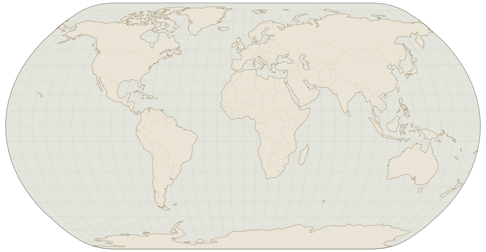
An example atlas on a world map: United States, Mexico, Portugal, Japan and Australia hatched in vermilion, and Iceland, Morocco, South Africa, Argentina and Singapore hatched in gold.
  • Explored, from your routes
  • Scratched off by hand

Skip past the map

Plate 5 Levels and medals

A level that never runs out.

Your level grows with every path you'd never taken. The first few come in a day; level 100 takes years of wandering; Atlas, at level 1,000, is there for the few who never stop.

Level 27 · Pathfinder. You've started finding the ways between places.

  1. Level 1: Newcomer
  2. Level 5: Wanderer
  3. Level 10: Rambler
  4. Level 20: Pathfinder
  5. Level 30: Trailblazer
  6. Level 50: Surveyor
  7. Level 75: Navigator
  8. Level 100: Cartographer
  9. Level 150: Voyager
  10. Level 250: Pioneer
  11. Level 400: Geographer
  12. Level 650: Wayfinder
  13. Level 1,000: Atlas

Atlas is about 190,000 km of paths you'd never taken.

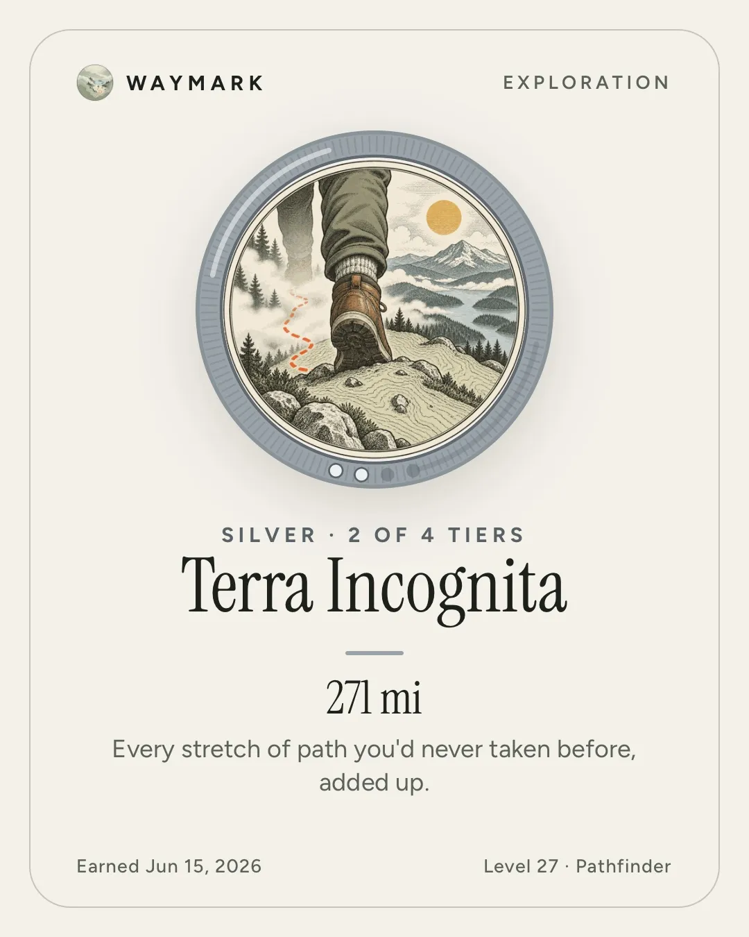
33 medals, in bronze, silver, gold and platinum.

For new ground, long days, early starts, new countries, and a few you'll find by accident. They have a tab of their own.

  • Terra Incognita Silver
    Every stretch of path you'd never taken before, added up.

  • Globetrotter Gold
    The world, one continent at a time.

  • Early Bird Bronze
    The city before it wakes up belongs to you.

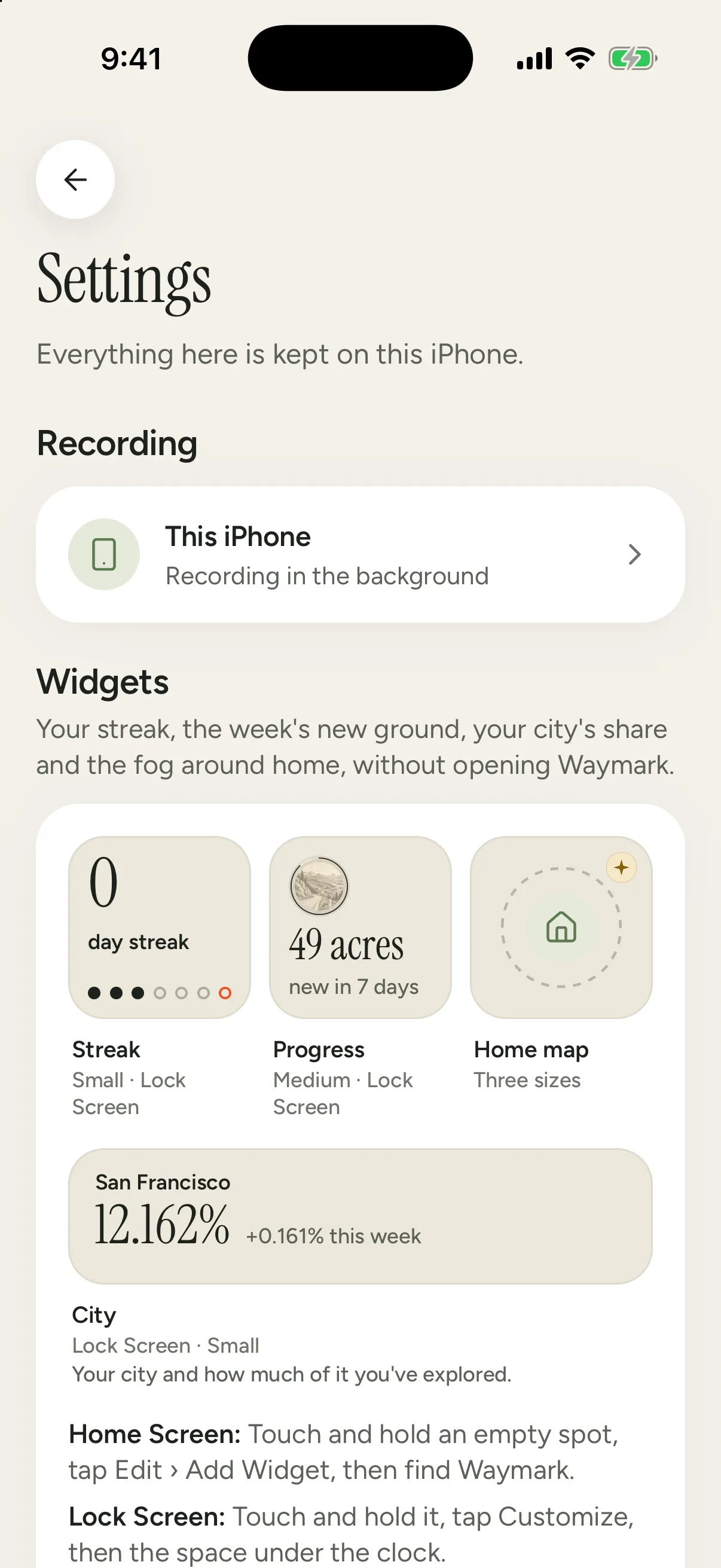
Waymark's Settings, headed: Everything here is kept on this iPhone. Below it, Recording with This iPhone, and Widgets, with tiles for Streak, Progress, the Home map and City.

Plate 6 Privacy

Your map never leaves your phone.

No account, no ads, and your location is never sold.

  1. No account. There's nothing to sign up for and nothing to sign in to.
  2. Nothing collected. Your routes, your photos' locations and your medals live on your iPhone. The App Store label reads “Data Not Collected”.
  3. Yours to take. Export everything as GPX, CSV or JSON whenever you like. Export is free, and stays free.

No account No ads No trackers Never sold

Location data is a business. We're not in it.

Many free apps pay for themselves by passing your location to advertisers and data brokers, often through code you never see. Brokers resell it, and in 2024 the US Federal Trade Commission banned several of them from selling people's sensitive location data. Waymark is paid for by a one-time purchase instead, so there's nothing to sell.

Sealed. The map is yours, and it stays in there.
Your journeys, places and photos
Stay on this iPhone. We never receive them. The usual app: uploaded to the company's servers.
Map tiles and terrain
Downloaded like any map. The map services see an IP address and which squares were asked for: never who you are, never your routes.
An account
None. Nothing to sign up for. The usual app: required, with your email or phone number.
Ads, analytics, trackers
None. The app has no ad, analytics or crash-reporting code. The usual app: ad code that can see your location.
Your location
Never sold, never shared. The usual app: passed on to advertisers and data brokers, who resell it.
Backup
Off unless you turn it on, then only to your own iCloud Drive.
Friends
Optional groups through iCloud: friends see your name, your last city and how much of each place you've explored. Never your map. The usual app: your live location, on the company's servers.
What we collect
Only an email, and only if you join the Waymark One waitlist on this site.
Leaving
Export everything as GPX, CSV or JSON, free. The usual app: locked in, or a paid extra.

Map pieces come in; your map never goes out. Waymark downloads the map from OpenFreeMap and terrain from Amazon Web Services, like any map app. Read the privacy policy

Plate 7 Waymark One, later

An engraving of a small pebble-shaped tracker clipped to a canvas strap.
Concept drawing. The design isn't final.

Waymark One, later.

A small tracker that logs your walks all day without touching your phone's battery, and aims for weeks between charges. Today it's a working prototype on a bench, not a product. If enough people want one, we'll build it.

One email when you can order one. That's all. Leave the list any time.

Pricing Free, and one purchase

Everything that records, imports, exports and measures is free, forever.

The free app is complete: no ads, no account, no limits on your history. Waymark Plus is how you support it, with a few ways to make the atlas yours.

Waymark

Free

and it stays that way

  • The fog and explored ground
  • Recording with your iPhone
  • Record automatically
  • Every import: photos, Health, files, Google Timeline, Fog of World
  • Export to GPX, CSV and JSON
  • Levels and medals
  • The scratch map
  • Share cards
  • The passport, by year and month, and sharing it
  • Replay of the last 30 days, and its video
  • The Atlas map
  • Streak, Progress and City widgets

Waymark Plus

Make the atlas yours. Pay once, keep it.

$5.99, once

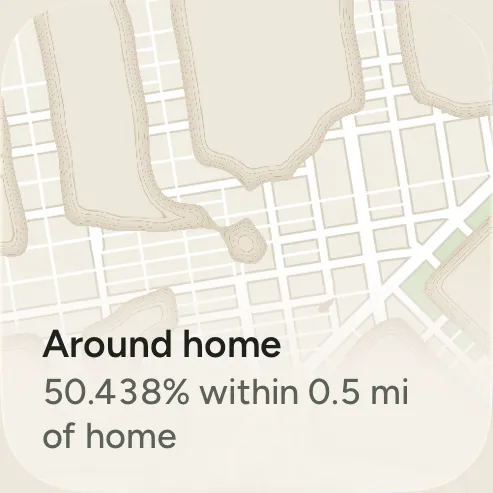
Waymark's Home map widget on the Home Screen: the fog around home, captioned Around home, 50.438% within 0.5 mi of home.
Home map widget Your fog on the Home Screen, small, medium or large. You pick the place and the zoom.
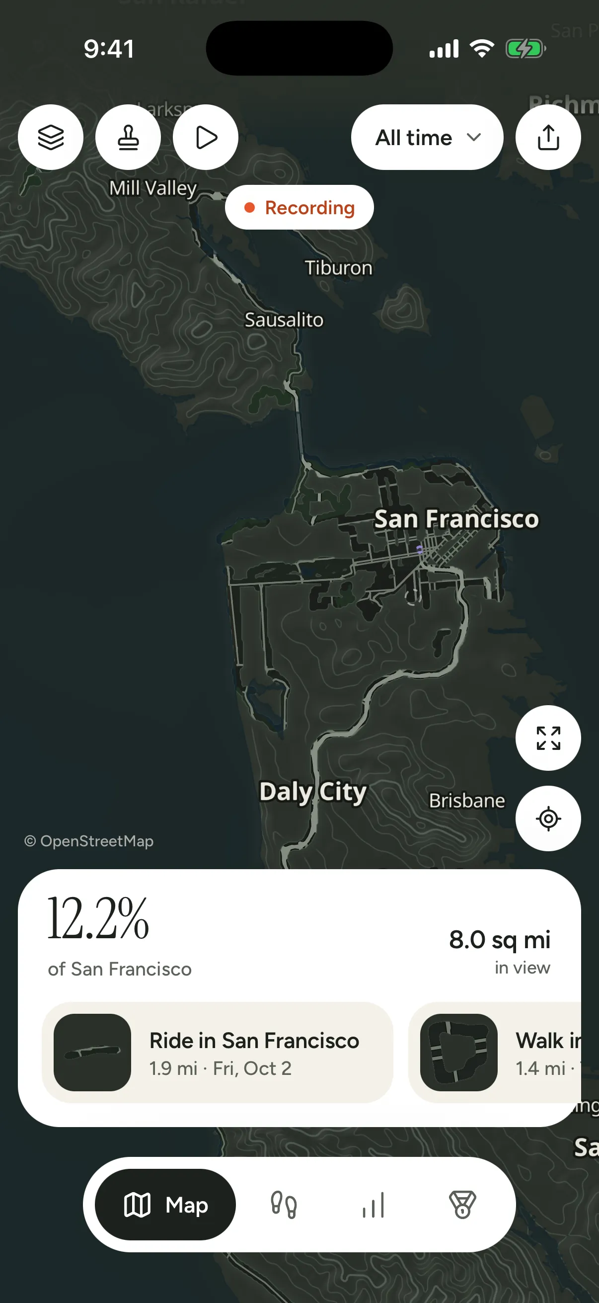
The Night map over San Francisco: the atlas inked in reverse, the explored streets drawn light.
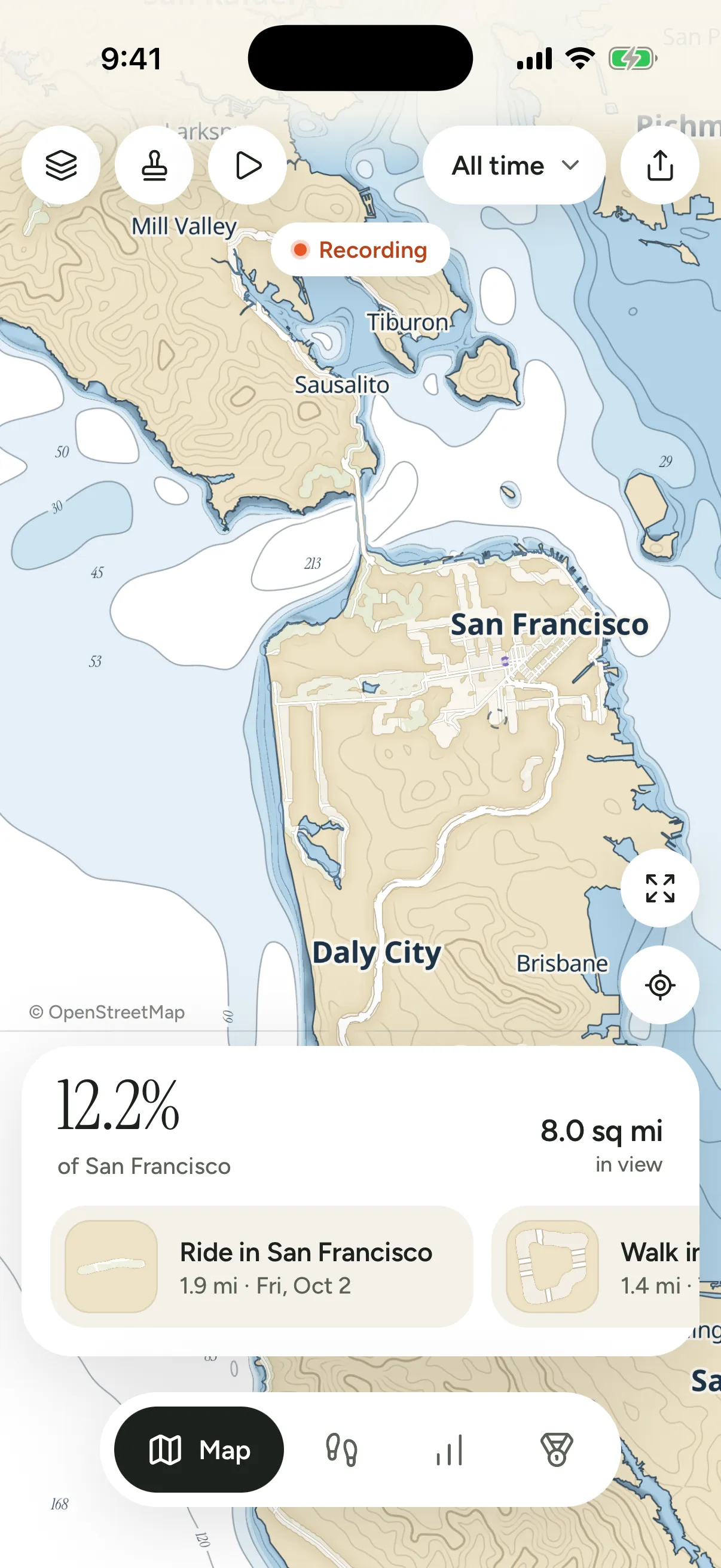
The Chart map over San Francisco: buff land, navy ink, and a pale blue sea with depth contours.
Night and Chart maps The atlas inked for evenings, or as a sea chart.
  • Replay all of your history. Watch your map fill in from your first walk to today. The last 30 days play free.
  • Home map widget. The fog around home, or any place you track, on your Home Screen.
  • Night map. The atlas inked in reverse, for evenings.
  • Chart map. A nautical chart: depth soundings, a white sea, buff land.

No subscription. Pay once and keep it. Family Sharing included. Plus is what pays for Waymark, so it never needs ads.

Get Waymark on the App Store

Questions, answered plainly.

Waymark in brief

  • Waymark is an iPhone app that keeps a private atlas of everywhere you've been: a parchment fog over the real map of the world that clears wherever you walk, ride or drive.
  • All your data stays on your iPhone. There's no account and no Waymark server, and your location is never sold or shared.
  • Waymark is free. Waymark Plus is a one-time purchase of $5.99 in the US, with no subscription.
  • It imports geotagged photos, Google Maps Timeline, Apple Health workouts, Strava archives, GPX, FIT, TCX, KML and GeoJSON files, and Fog of World.
How do I get started?

Download Waymark, swipe through four short pages, and allow location, then Always, so walks count even when the app is closed. With Record automatically on there's nothing to press: go for a walk and the fog clears. The quick start covers your first day.

Is my location data uploaded anywhere?

No. Your routes, places and photo locations stay on your iPhone, and Waymark never receives them: there's no account and no Waymark server. The app only downloads the map itself, map tiles from OpenFreeMap and terrain from Amazon Web Services, which see your IP address and which pieces of the map were asked for, never your routes. Two things go out only when you use them: an address you type to set a place goes to Apple's search, and if you join a friends group, your name, the city you were last in and how much of each place you've explored are shared with that group through iCloud, never your map. If you turn on Back up to iCloud Drive, a daily backup goes to your own iCloud Drive.

How much battery does it use?

GPS runs only while you're moving and sleeps when you're still, so a normal day costs a few percent of battery, and usually under 10 % even on a long one. About 1–3 % an hour while walking with the screen off, 2–5 % on a day with an hour of walking, and under 1 % a day with Places only. These are estimates; the one day we've measured so far, with a 4 km walk, used about 3 %. The screen is the big one: 10–20 % an hour with the map open, as with any map. More on battery.

Do I have to press record?

No, if you allow Always location. Waymark can start by itself when you set off and rest when you stop. You can also start and stop it yourself, or use Places only to note cities and countries for almost no battery.

Can I import my history from Google Maps Timeline, Strava, Fog of World, GPX or Apple Health?

Yes, all of them. Waymark reads geotagged photos, Google Maps Timeline exports, Strava's account archive, GPX, FIT, TCX, KML and GeoJSON files (from Garmin, Komoot, AllTrails and others), Fog of World's Sync folder, and workouts straight from Apple Health. Everything is read on your iPhone, and each import shows a preview and can be undone. Bring in your history walks through each one.

Does it work offline?

Recording does: GPS needs no connection. Terrain is kept on your iPhone once it's downloaded, so the contour lines work offline too. The base map needs a connection the first time you look at a new place.

Is it a subscription?

No. Waymark is free, and Waymark Plus is a single purchase of $5.99 in the US that adds a replay of all your history on the map, a Home Screen map widget, the Night map and the Chart map. Pay once and keep it. Everything that records, imports, exports and measures stays free.

Can I watch my map fill in?

Yes. Replay plays your history back on the map in order: the fog lifts where you went, photos appear where and when you took them, and the date ticks along. Busy days get more time and empty months pass quickly. It never draws inside a hidden place, and you can share it as a video. The last 30 days play free; Waymark Plus plays all of it. The sample atlas, offered the first time you open Waymark, plays whole for everyone.

Can I share where I've been?

Yes, with your passport: one page of the countries you've been to on a world map, with their flags, how many states and cities, the ground you've explored and your share of the world, for all time, a year or a recent month. Share it as a story or a square image. It shows only counts and countries, never where you were, and it's free.

Do I need the Waymark One tracker?

No. Your iPhone is all you need. Waymark One is a small tracker for logging all day without your phone; today it's a working prototype, and it isn't for sale.

What happens if I get a new phone?

Turn on Back up to iCloud Drive and Waymark keeps a daily backup in your own iCloud Drive. Restore it on the new phone and everything comes back. You can also save a backup file and keep it wherever you like. Backups, step by step.

Is there an Android version?

Not yet. The fog is drawn by code written for iPhone. If Waymark does well there, Android is the next thing to look at.

iPad or Apple Watch?

iPhone only for now. Workouts recorded on an Apple Watch come in through Apple Health.

Who makes Waymark?

Simon Ilincev, in Ithaca, New York. Write any time: simon@simonilincev.com.

Where do I get help?

The support pages cover recording, imports, backups and Plus. For anything else, write to simon@simonilincev.com.


The map fills in as you go.

Waymark A private atlas of everywhere you've been

Download on the App Store

Free. Plus is a one-time purchase.

Reading this on a computer? Point your iPhone's camera here.